Assumptions
Effective territory management implies, above all, the ability to operate with relevant data describing various aspects of its functioning.
In practice one often encounters a situation where the data necessary to develop a complex management decision either "scattered" across different information systems of municipal, regional and federal levels, often duplicating or contradicting each other, or simply absent.
In this case, the public sector customer must also take into account what information systems at his level of competence must be created on a mandatory basis in accordance with applicable law.
Для работы с ИСОГД, очевидно, необходимы и актуальные данные Росреестра по земельным участкам и объектам капитального строительства, следует учитывать, что они находятся в информационной системе федерального уровня ЕГРН), откуда их нужно своевременно заказывать и получать.
Инвесторам и просто ведущим свою производственную деятельность на территории субъекта РФ организациям необходимо получать актуальную информацию по пространственным данным, к которым как раз и относятся картографическая основа, инженерные изыскания и данные дистанционного зондирования, иметь доступ к которым, в соответствии с действующим законодательством, предполагается через региональный фонд пространственных данных (РФПД), а публикацию данных которого наиболее удобно осуществлять через региональный портал пространственных данных (РППД).
To work with the spatial planning system it is obviously necessary to have up-to-date federal land register data on land plots and construction objects where they must be timely ordered and received.
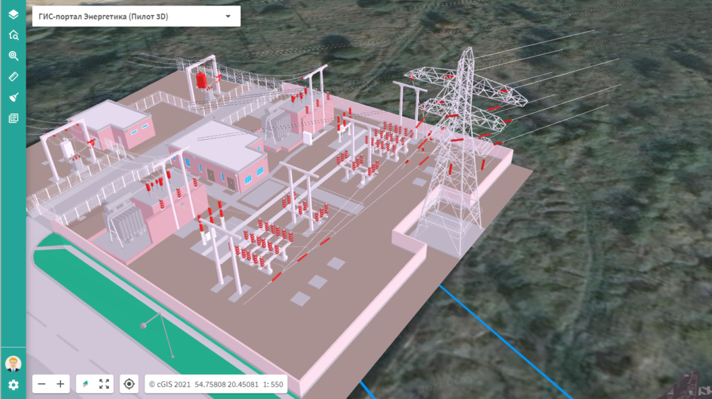
Evidently, spatial planning system should also deal with building information models (BIM) to cover the whole territory lifecycle.
Problem solution
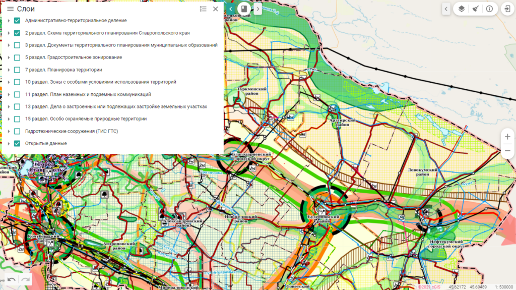
Here is how, using the example of the Stavropol Region Territory, using the cGIS platform we managed to create such a common information space quickly and efficiently and to create the spatial planning system and spatial data portal.
The initial situation in the implementation of the project, which started in 2020, was typical for most regions of the Russian Federation. More than 30 municipalities of the Stavropol Territory conducted their activities using different information systems or file storages.
Платформа-агрегатор cGIS позволила силами местного подрядчика самостоятельно осуществить в кратчайшие сроки миграцию данных в единое информационное пространство с их последующим реинжинирингом для обеспечения совместного использования. В результате, в единое информационное пространство Ставропольского края были перенесены и упорядочены около 600 000 пространственных объектов и около 450 000 связанных с ними документов, а с помощью специально разработанных интеграционных сервисов данные существующих отраслевых информационных систем регионального уровня также были интегрированы в единое информационное пространство. Общий объем хранилища данных составил почти 2 Тб.
Besides that the common information space of Stavropol Region included the data of the federal United Electronic Cartographic Base (UEKO) and OpenStreetMap.
С использованием входящих в комплект поставки платформы-агрегатора cGIS сервисов связи со СМЭВ 3 была осуществлена интеграция единого информационного пространства Ставропольского края с ЕГРН.
The development of the spatial planning module was also done with the help of the Stavropol Region Territory developers, without any additional training, because the cGIS data aggregator platform supports the use of the CUBA framework.
After the stage of test operation and necessary managerial activities, the certification of the State Information System of Urban Planning Activities was completed; this system was transferred into commercial operation and over 250 employees from 33 municipal entities and 7 regional bodies of executive power were given the regulated access.
At the moment the open part of GISOGD and RPPD of Stavropol Region is available at https://gisogd.stavregion.ru

What's next?
Базовые возможности оперирования различными источниками данных, развитые интеграционные возможности платформы-агрегатора cGIS и простота разработки пользовательских приложений на ее основе позволили быстро и эффективно решить задачу создания единого информационного пространства Ставропольского края ГИСОГД и РППД Ставропольского края.
And the advanced functionality of the cGIS data aggregator platform allowing to include BIM-models and laser scanning data into the common information space will make it possible to fully implement these features in 2022.