
It is not easy to sum up the results of such a difficult year.
Let's start with the main thing: the cGIS Pro platform not only evolved as planned, but also grew up dramatically in new functionality.
For this we are grateful not only to the development team, but also to our customers, who have tirelessly generated requests to implement their specific tasks using the rich feature set of cGIS Pro.
Constant contact with customers and the synthesis of their wishes formed a significant part of the roadmap for the development of our platform in 2022.
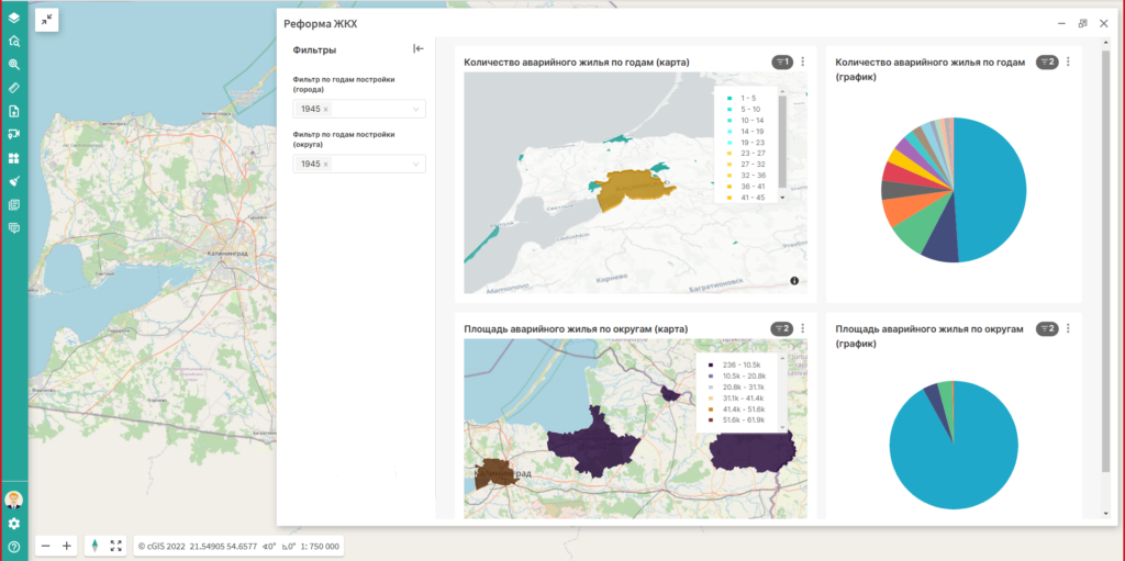
The emphasis was placed on both increasing the loading capacity (in some cases, the number of simultaneously displayed objects reached 30,000,000) and expanding the functionality of the search and analytical capabilities of the platform. We will tell you more about this later in this article. It's nice that none of the implemented cases gave the feeling that we reached the limit of the technological way selected, in each case we were exclusively focused on the development of additional modules and services within the chosen technological stack. We will, of course, tell you about the specifics of individual projects in separate articles, but for now let's just thankfully list the implementations that have already been carried out in 2022 in the Administration of St. Petersburg, NLMK-Engineering and Rosseti-Yantarenergo JSC.
The possibility of embedding the user interface elements of third-party BI applications was present in cGIS Pro for a long time, it was used for embedding dashboards from i.e. Polymatica or Microsoft Power BI software products, among others. Now it is possible to use embedded dashboards containing 3D supported cartographic components.
In cGIS Pro it is now possible to bind documents (files of any format) to any element of the common information space formed by cGIS Pro: projects as a whole, objects on the map, BIM models, and even individual elements of BIM models. Linked documents can be viewed both at the level of the whole project and at the level of a specific BIM model.
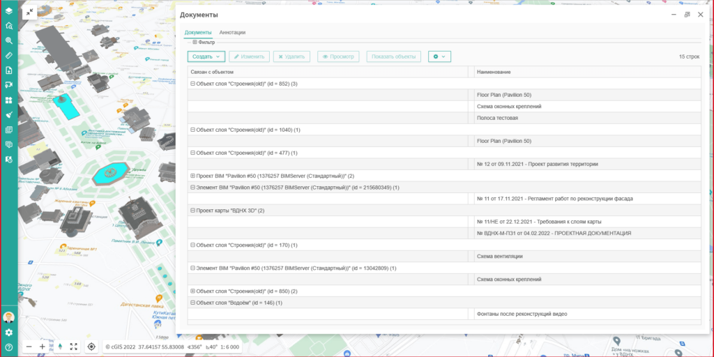
For documents in common formats (Microsoft Word, OpenOffice Word, Adobe PDF) full-text content search is also supported.
As with documents, annotations can also be attached to projects, map objects, BIM models and their elements - a kind of remarks that are more similar to tickets (issue) in issue trackers. You can specify type, stage, status and priority for remarks. Among other things, comments can be added to the remarks. The attribute set is maximally close to BCF (BIM Communication Format) annotations in terms of unloading remarks together with BIM models, a certain reserve for the future.
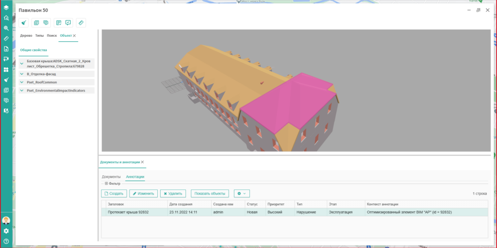
Similar to linked documents, annotations also support searching the content of comments and comments on them.
It is now possible to get attribute values of 2D/3D vector layers when hovering mouse cursor over an object. The displayed set of attributes is set separately for each layer.
A cGIS Pro BIM model viewer allows multiple BIM models to be loaded. Their internal structure will be displayed as a single tree.
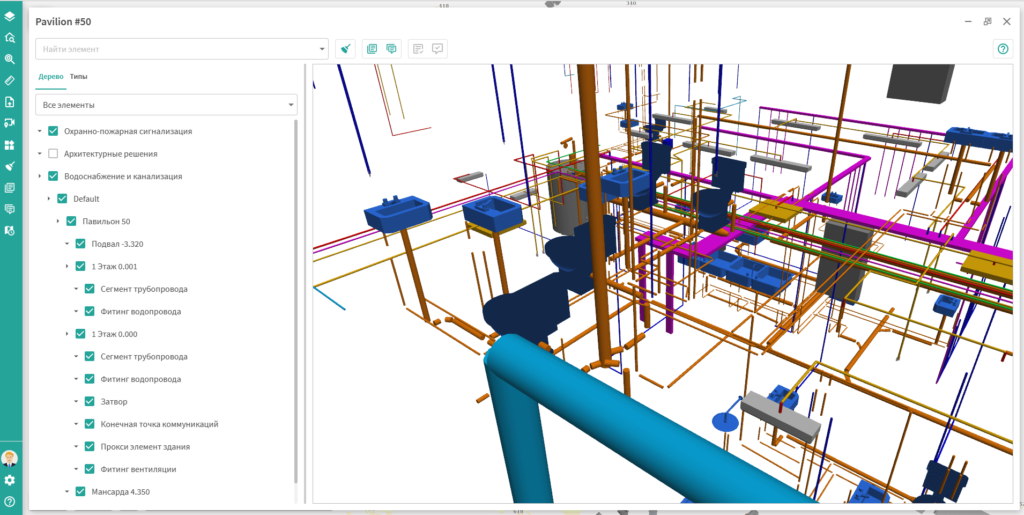
This feature is especially useful when working with complex models that consist of several branch models (electrical networks, plumbing, ventilation), each of which is designed separately and often by different companies. The BIM model viewer brings the model parts together for subsequent work with them as a single model.
In the cGIS Pro BIM model viewer there is a new search tab that allows you to search both by model element names and by value of their properties. The search area extends to all BIM models displayed in the window.
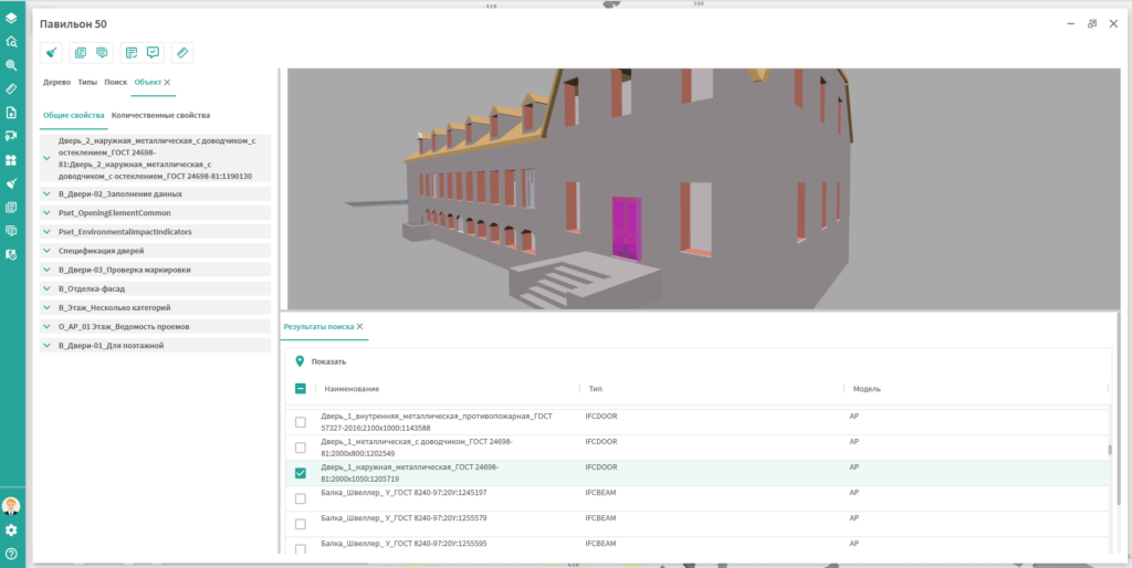
The search results are displayed line by line in the form of a table, providing sorting and filtering options by column. One can select one or more items in the table and approach them on the model.
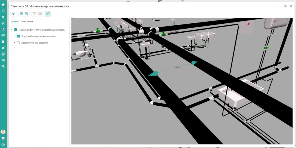
While viewing a BIM model in a separate window, one can now enable measurement mode in which one can measure distances between model elements with automatic snap to elements. The measured distances are displayed directly in the model as dimension lines.
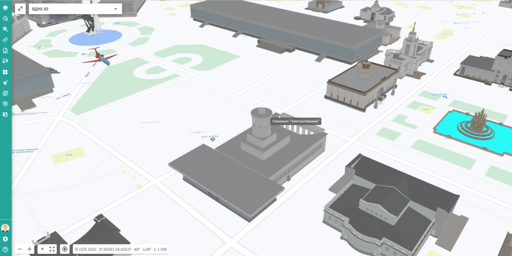
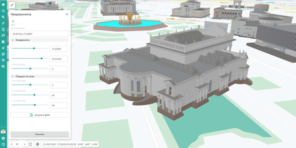
Traditionally, models of buildings and structures are placed on the map according to precise coordinates in order to match their actual position in reality as much as possible. But what if we need to solve a slightly different problem - to see how the next architectural masterpiece fits into the existing urban environment? In this case it would be much more convenient to work with the model interactively right on the map, moving and turning it in the various directions. And such an opportunity has appeared in cGIS Pro!
According to the experts opinion the analysis of the position of objects in virtual reality is of highest priority nowadays. For our part, we have taken another step in this direction. At any time, the user can switch on the first-person map view mode and travel through the streets of the virtual city to see its sights. At the same time, the choice of the initial location of the virtual camera and the object to which the user's gaze will be directed becomes available.
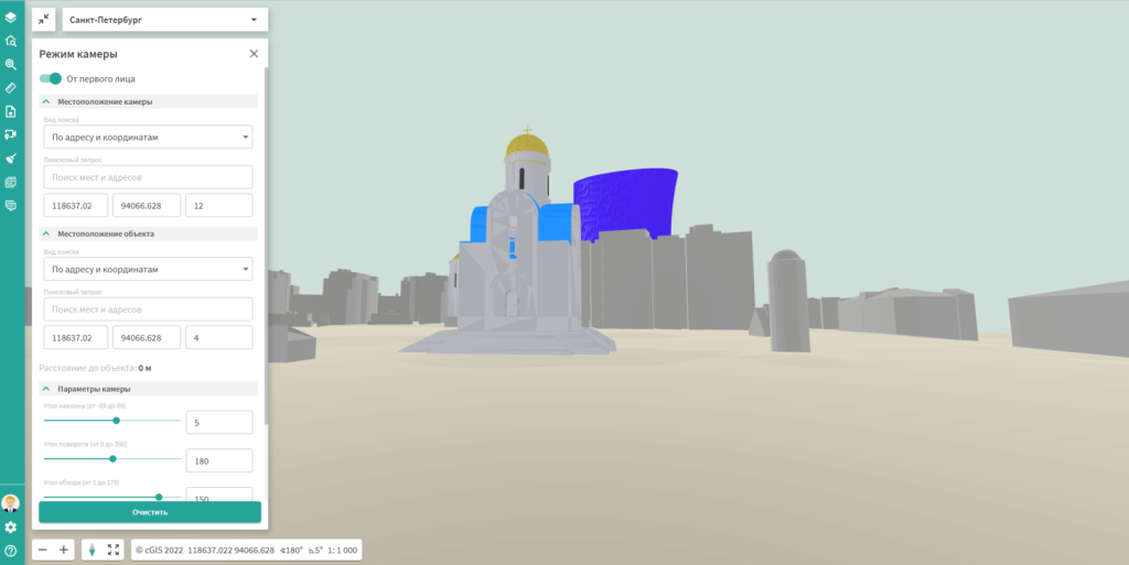
This function can be used, for example, by architects who have the opportunity to see with their own eyes whether the planned new buildings will violate the legally protected historical views of the city. One can also use cGIS Pro's existing flyover function to play the role of a sightseer following one of the city's popular hiking trails.
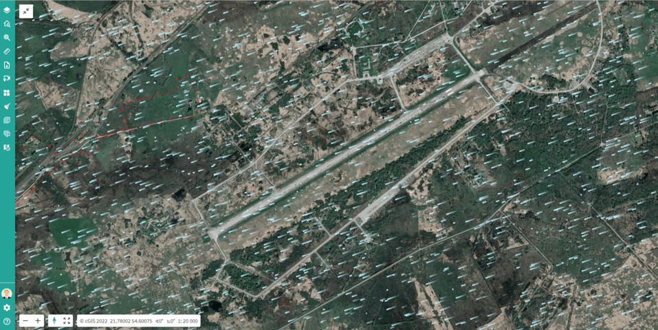
Not only three-dimensional models, but also three-dimensional tiles and point clouds can act as objects in a three-dimensional scene.
Often users of large enterprises and municipalities need the ability to work not only in geographic coordinate systems (i.e. WGS-84), but also in rectangular coordinate systems used by surveyors.
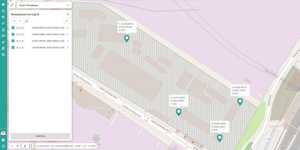
Work in rectangular coordinate systems supports not only the usual map mode, but also the mode of work with the map of the first person.
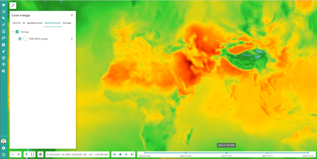
At the end of the review of cGIS Pro innovations we would like to mention two new types of layers - weather layers and time layers.
Weather layers are layers animated in a certain way, which are most often used to display the distribution of weather phenomena (wind direction, cloud cover, precipitation). Of course, a layer of this type requires data prepared in a certain way, but interested users usually have such data.
Time layers display the state of their objects for a selected period of time. For example, if the reservoirs layer has weekly data during the summer dry period, you can subsequently analyze changes in reservoir water levels, for example, during the month of July. And cGIS Pro is able to show the change of objects in the layer dynamically through animation.
To summarize the results of the year, we are pleased to note the rapidly growing network of our partners, who appreciated the prospects of expanding their business using cGIS Pro. According to them, the rich functionality of cGIS Pro "out of the box" made it possible to convince the most demanding customers, while our principled adherence to all existing international standards made it possible to fully use the potential of our partners' own staff.
So, together, let's take off!